PALMS+: Modular Image-Based Floor Plan Localization Leveraging Depth Foundation Model
Yunqian Cheng ⋅ Benjamin Princen ⋅ Roberto Manduchi
Abstract
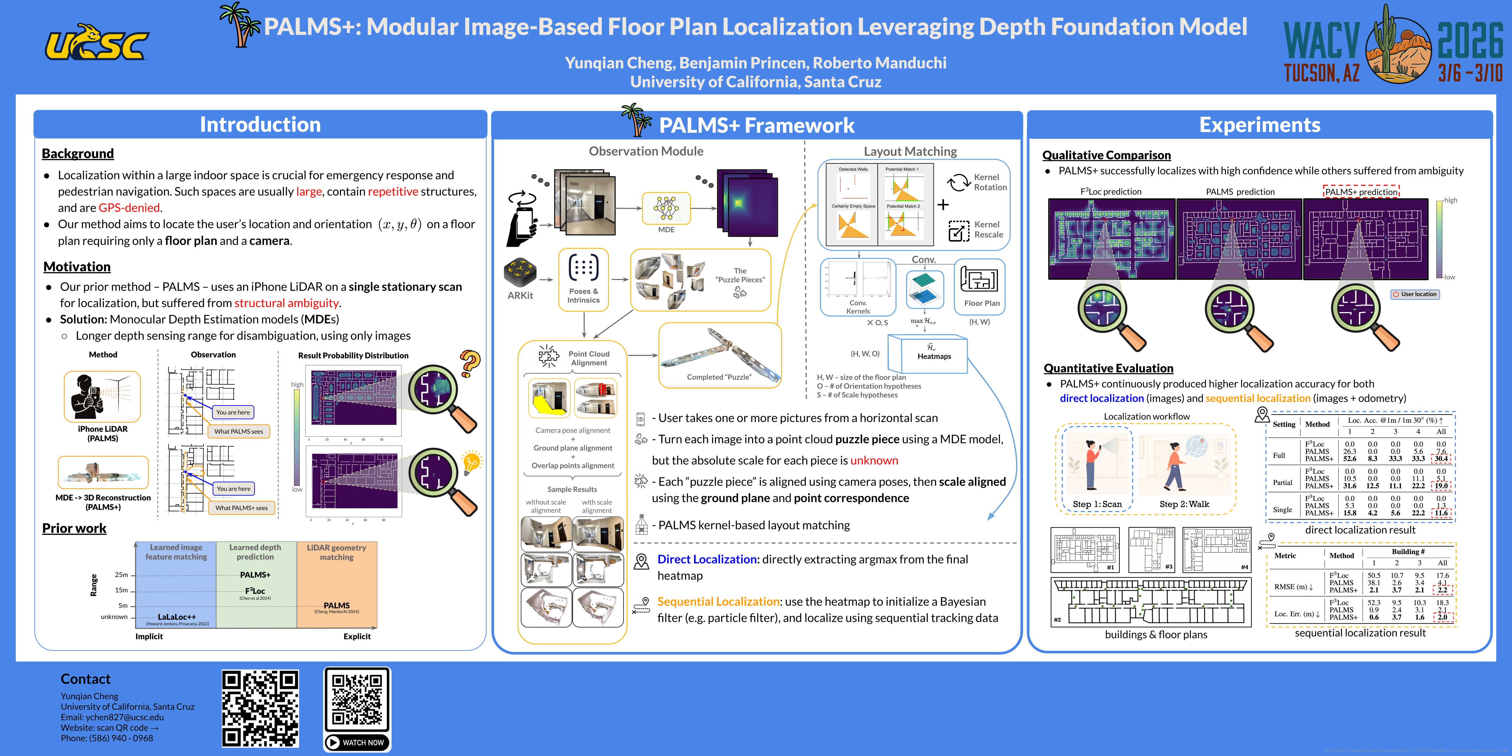
Indoor localization in GPS-denied environments is crucial for applications like emergency response and assistive navigation. Vision-based methods such as PALMS enable infrastructure-free localization using only a floor plan and a stationary scan, but are limited by the short range of smartphone LiDAR and ambiguity in indoor layouts. We propose PALMS+, a modular, image-based system that addresses these challenges by reconstructing scale-aligned 3D point clouds from posed RGB images using a monocular depth model (Depth Pro), followed by geometric layout matching via convolution with the floor plan. PALMS+ outputs a posterior over the location and orientation, usable for direct or sequential localization. Evaluated on the Structured3D and a custom campus dataset consisting of 80 observations across four large campus buildings, PALMS+ outperforms PALMS and F$^3$Loc in stationary localization accuracy—without requiring any training—highlighting its potential for scalable, infrastructure-free deployment. Notably, PALMS+ achieves performance that is better or at least comparable to baselines, even when using just a single image as input, while baselines rely on full panoramic views. Our code and data will be released upon acceptance.
Chat is not available.
Successful Page Load