QC-SF: Improving Computer Vision for Airborne LiDAR Point Clouds of Boreal Forests with Quebec Simulated Forest Dataset
Abstract
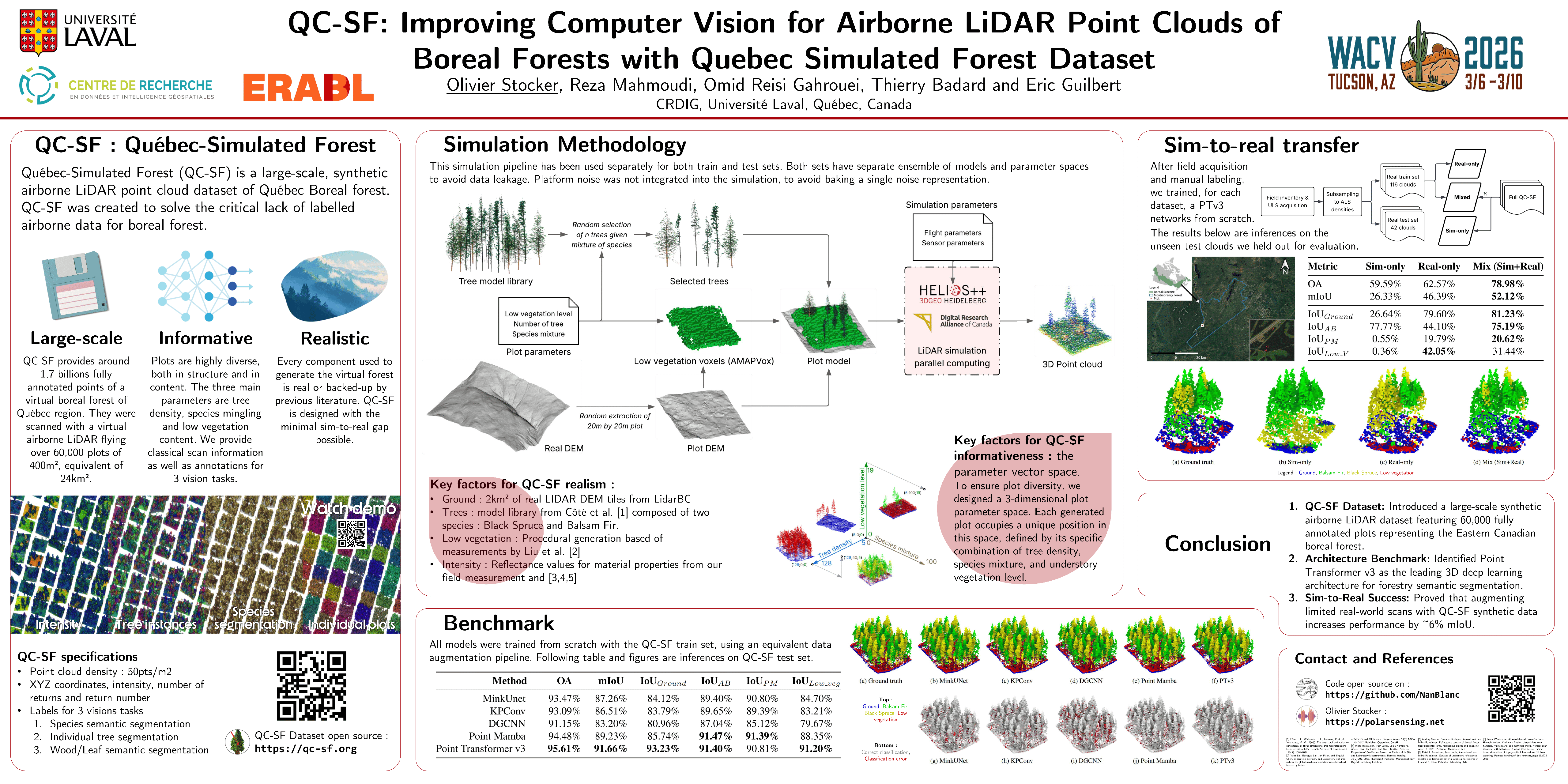
Boreal forest ecosystems are under immense pressure, and while airborne LiDAR has emerged as a powerful monitoring tool, leveraging its large data volumes requires automated analysis. Deep learning methods offer a solution but are hindered by the scarcity of large-scale, labeled datasets in forestry, contrasting to the data-rich urban environments.To address this gap, we introduce the Quebec Boreal Sim (QC-BS), a large-scale, synthetic airborne LiDAR dataset fully labeled for semantic segmentation. QC-BS contains 60,000 forest plots, each composed of a controlled mixture of two dominant species in Quebec's boreal forest: Black Spruce and Balsam Fir. Using this benchmark, we evaluate the performance of four state-of-the-art point cloud networks: KPConv, MinkUNet, DGCNN, and Point Transformer V3.Our results identify Point Transformer V3 as the most effective architecture, achieving 91.66\% mIoU. Furthermore, we validate the sim-to-real transferability of our dataset, demonstrating that augmenting a small number of real-world scans with our synthetic data improves segmentation performance by 6\% in mIoU score. [Our dataset will be made publicly available upon acceptance].